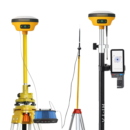
Features
- Lightweight
- Compact and fast measurement
- Inertial navigation
- Support BeiDou 3
- Full protocol built-in radio
Technical Specifications
| Channels | 800+ |
| GPS | L1/L2/L5/ L2C |
| BDS | B1/ B2/ B3/ B1C / B2a |
| GLONASS | L1/ L2/ L3 |
| Galileo | E1/E5 AltBOC / E5a / E5b / E6 |
| SBAS | L1/L5 |
| QZSS | L1/L2/ L5/ L6 |
| IRNSS | L5 |
| High-precision static GNSS Surveying | Horizontal: 0.09 in (2.5 mm) + 0.1 ppm RMS Vertical: 0.13 in (3.5 mm) + 0.4 ppm RMS |
| Static and Fast Static | Horizontal: 0.09 in (2.5 mm) + 0.5 ppm RMS Vertical: 0.19 in (5 mm) + 0.5 ppm RMS |
| Post Processing Kinematic | Horizontal: 0.31 in (8 mm) + 1 ppm RMS Vertical: 0.59 in (15 mm) + 1 ppm RMS |
| Initialization time: Typically, 10 min for base and 5 min for rover | |
| Initialization reliability: Typically, > 99.9 % | |
| (PPK / Stop & Go) | Horizontal: + 9.84 in (+ 0.25 m) + 1 ppm RMS |
| Code Differential GNSS Positioning | Vertical: + 19.6 in (0.5 m) + 1 ppm RMS | SBAS: 19.6 in (0.5 m) H, 33.46 in (0.85 m) V |
| Real Time Kinematic (RTK) | Horizontal: 0.02 in (8 mm) + 1 ppm RMS Vertical: 0.04 in (15 mm) + 1 ppm RMS |
| Initialization time: Typically, < 10 s Initialization reliability: Typically, > 99.9 % | |
| Time to first Fix | Cold start: < 45 s| Hot start:< 30 s| Signal re-acquisition: < 2 s |
| Hi-Fix | Horizontal: RTK + 0.032 in (+ 10 mm) / minute RMS Vertical: RTK + 0.065 in (+ 20 mm) / minute RMS |
| Tilt Survey Performance | Additional horizontal pole-tilt uncertainty typically less than |
| 0.026 in to 0.002 in (8 mm or + 0.7 mm) or 0.098 in (2.5 cm) accuracy in the inclination of 60 ° | |
| Communication | Bluetooth: 4.2 or 2.1 + EDR, 2.4 GHz |
| Wi-Fi: frequency 2.4 GHz, Supports 802.11 b/g/n | |
| Internal UHF Radio | Frequency:410 MHz to 470 MHz
Channel:116 (16 scalable) |
| Transmitting power:0.5 W or 1 W or 2 W adjustable | |
| Supports multi-communication protocols: HI-TARGET, TRIMTALK450S, | |
| TRIMMARK III, TRANSEOT, SATEL-3AS, etc. | |
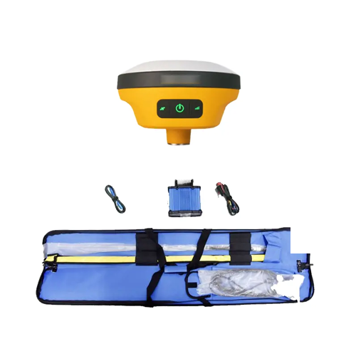
| Internal Battery | Internal 7.4 V or 6800 m Ah lithium-ion rechargeable battery. |
| RTK Rover (Network) for 12 hrsStatic: up to 15 hrs | |
| External Power | Power consumption: 4.2 WDimensions (Width x Height): 4.84 in x 2.63 in (132 mm x 67 mm) |
| Charging: using standard smartphone chargers or external power banks. | |
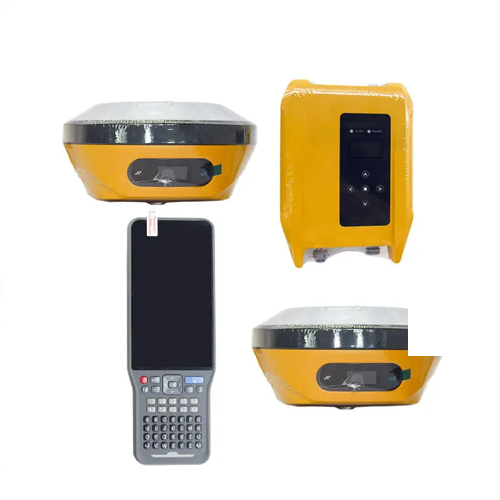
| LED Lamp | Satellite, Signal, Power |
| Physical Button | 1 |
| Water or Dustproof | IP67 |
| Shock And Vibration | Designed to survive a 78.74 in (2 m) natural fall onto concrete |
| Humidity | 100 %, condensing |
| Operation Temperature | -22 °F to 158 °F (-30 °C to 70 °C) |
| Storage Temperature | -40 °F to 176 °F (-40 °C to 80 °C) |
| 1 x USB Port, Type C | |
| 1 x SMA Antenna Connector | |
| Output Rate | 1 Hz to 20 Hz |
| Static Data Format | GNS, Rinex |
| Network Model | VRS, FKP, MAC; supports NTRIP protocol |
| CMR& RTCM | CMR, RTCM 2.x, RTCM 3.0, RTCM 3.2 |
| Navigation Outputs ASCII | NMEA-0183 |


Reviews
There are no reviews yet.